
Day 37: Lyell to Glenhope
Journal for 2014-11-26 | Published on 2014-11-28 22:11:15After a very stormy night, which meant not much restful sleep (the wind howled like a banshee and the rain hit the tent with a fury, even though we were semi-protected under the tree), we woke to blue skies with puffy white clouds. Unfortunately, Pam is not very personable after getting little sleep, and we quarreled about silly things, but eventually we ate breakfast, broke camp and got on the road.
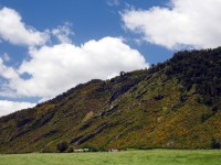
We were now riding the Upper Gorge of the Buller River, and it was just as scenic as the Lower Gorge. Today, however, we could see the tops of the mountains, and the clouds moving fast, and we stopped many times to take pictures. We passed by the longest “swing” bridge in NZ, but didn’t feel like paying $10 each to walk across it. We saw a sign for where the 1929 earthquake had upthrust the ground, but everything is covered over with green growing things, so it’s difficult to see where the damage was done.
The km seemed to pass by quickly today, as we climbed up the gorge to Murchison. The last 10 km to Murchison, the valley opened up, and the wind hit our backs, and we had a great, fast ride into town. We had lunch at a picnic table in town, and Matt went into the supermarket to purchase supplies for the next few days. We knew we were about halfway to our goal for the day, and had plenty of time to do it. We were to continue climbing with the Buller River, until Kawatiri Junction, where we would leave the Buller and head toward Hope Saddle. The wind was a wonder, and even though we were climbing, it was generally at our backs (except when it wasn’t, of course) and it helped us climb and climb. At one point, we rode right next to some wild turkeys, and considered whether or not we should try to catch one so we can have a true Thanksgiving dinner, but upon further reflection, decided it wasn’t such a good idea. We paused at a picnic bench for a snack and to remove outer wear, as it was quite warm and looking to stay that way. Then it was on to Kawatiri Junction, where there was a little display about the failed railroad, and we walked down to the abandoned tunnel. Kind of sad to see all the hard work that went into it, and know that it was all for naught.
Just 10 km up from Kawatiri Junction, we came to Hu Ha bikepackers, and even though the wind was helping us out immensely, and we might have been able to go further today, we decided to get a good night’s rest tonight and finish tackling the Hope Saddle tomorrow. We’ve climbed a good portion already, but the steepest parts are coming up, and it’s better to rest up, save it for another day.
Distance: 80.04km
Time: 4:56
Average: 16.22kmh
Max: 58.66kmh
Climb: 954m
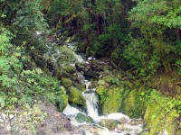
Small roadside waterfall which led to...
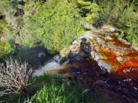
A large waterfall on the other side, the water is brown colored from flowing through the tanin in decomposing leaves.
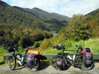
Our bikes :)
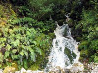
Another roadside water fall
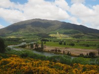
View from outside of Murchenson
Nice view of a valley
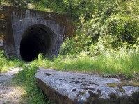
Old railroad tunnel near Katiri Junction.
0 guestbook posts. Click here to post one.